Fishing The Colorado River
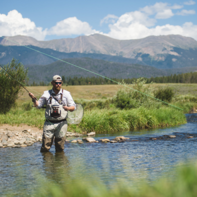
Explore the Colorado River in Winter Park
The mighty Colorado River carved the Grand Canyon millions of years ago and has its headwaters in Grand County on the west side of the Continental Divide in Rocky Mountain National Park. It begins as a tiny stream on La Poudre Pass draining a wet meadow. Fed by many tributaries along its 1400 mile journey, it flows southwest through the Colorado plateau country of western Colorado, southeastern Utah and northwestern Arizona where it flows through the Grand Canyon. It turns south near Las Vegas, Nevada forming the Arizona–Nevada border in Lake Mead and the Arizona–California border below Hoover Dam. Before entering Mexico in the Colorado Desert, most of its waters are diverted into the Imperial Valley in Southern California and Yuma County, Arizona where ⅔’s of the nation’s winter vegetable crop is grown. 40 million people depend on this precious resource for drinking water. In Mexico, its course forms the boundary between Sonora and Baja California before entering the Gulf of California.
Colorado State Fishing Rules & Regulations
Always refer to the annual Colorado Parks and Wildlife Fishing Brochure for the most-up-to-date rules and regulations. It is available online, at the Winter Park Information Center, and typically at retail outlets that sell fishing licenses. Always respect private property near fishing access points
ACCESS #1: ROCKY MOUNTAIN NATIONAL PARK
35 miles from the Winter Park Information Center in Winter Park to the western entrance to RMNP. Follow HWY 40 for 18.4 miles, turn right onto HWY 34 west of Granby and continue 16.3 miles to the National Park entrance and Visitor Center.
SPECIES: Brown, Rainbow, Brook, and Cutthroat Trout.
REGULATIONS: RMNP fishing information and regulations are available at the RMNP Visitor Center.
TIPS: Easy walk-in fishing all along Route 34 from Grand Lake to the Colorado River Trailhead. View Map.
ACCESS #2: ROCKY MOUNTAIN NATIONAL PARK-SHADOW MOUNTAIN DAM TAILWATERS
Follow HWY 40 for 18.4 miles, turn right onto HWY 34 west of Granby and continue 11.5 miles to CO. RD. 66. Turn right for 1.3 miles and bear left for .1 miles then right .2 to the parking area. Camping, toilets, water, picnic tables. Walk along the dam to the intersection with the East Shore Trail and go right (south) to follow the trail along the east side of the Colorado River to Lake Granby. Fishing access along the trail. The trail on the west side can be accessed by parking in the area at the gate to the A Bar A Barn.
SPECIES: Brown and Rainbow trout, Kokanee Salmon.
REGULATIONS: Colorado State Fishing Regulations (Colorado Parks and Wildlife Fishing Guide), snagging prohibited, fishing prohibited Oct 1-Dec 31.
TIPS: Check on the flow below the dam before making the trip to this section; water releases can make the river difficult or impossible to wade. Be aware that you will find few places to cross the river safely, even at low flows.
ACCESS #3: GRANBY TRAILS FISHING ACCESS:
Follow HWY 40 west 18.4 miles, turn right onto HWY 34 west of Granby, and continue .5 miles to the Granby Trails entrance on the left. The Town of Granby has opened a mostly untouched section of the Colorado River to anglers with the opening of fishing beats within the larger Shorefox property at Granby trails. This section of the Colorado River is just above the confluence with the Fraser River and the fishery is Gold Medal quality. Anglers pay a reservation fee for a day pass to one of five sections, called beats, of the Colorado River. Granby Resident: $25 Non-Resident: $60 Reservations and payment may be made online (Click Here) or in person at the Town of Granby Town Hall, 0 Jasper Ave, Granby 970.887.3961 Mon-Fri only.
SPECIES: Brown and Rainbow Trout
REGULATIONS: Colorado State Fishing Regulations (Colorado Parks and Wildlife Fishing Guide) - Fly/lure only-catch & release
Designated Gold Medal Waters from the confluence with the Fraser River west of Granby downstream to its confluence with Troublesome Creek west of Parshall. Fairly flat with series of riffles, runs, pocket water, and deep pools. The river is wide, flattening out and slowing as it approaches Kremmling.
SPECIES: Brown and Rainbow Trout.
REGULATIONS: Colorado State Fishing Regulations with special restrictions in effect (Colorado Parks and Wildlife Fishing Guide)
TIPS: Best fishing in April & May before runoff, late June and July after runoff and Mid September-October. Early morning and evening best (all mileage originates from the intersection of US HWY 40 & 34 west of Granby 18.4 miles from the Winter Park Information Center).
ACCESS #1: 2.7 miles - Roadside pull-off on left side of HWY 40 overlooking Colorado River. Open access on both sides of the river.
REGULATIONS: Fly/lure only-catch & release
ACCESS #2: 9.3 miles - Town of Hot Sulphur Springs Pioneer Park- From HWY 40 turn right onto CO. RD. 20, turn left over the bridge. Camping, sanilets, picnic area. Over 1 mile of river on both sides. Access to the east end of Byers Canyon.
REGULATIONS: 2 trout limit
ACCESS #3: 11.6 miles - West end of Byers Canyon parking area on right off HWY 40. Steep, short trail to the river. Walk along canyon edge avoiding high water periods.
REGULATIONS: 2 trout limit east of the bridge. Fly/lure only-catch & release west of the bridge
ACCESS #4: 11.8 miles - Hot Sulphur Springs State Wildlife Area/Joe Gerrans Area.
From Hwy 40 turn left at the east end of the bridge onto CO. RD. 50. Camping, vault toilets. 2,300 acres on both sides of the river. From the parking area short hike down to the river.
REGULATIONS: Fly/lure only-catch & release
ACCESS #5: 11.9 miles - Hot Sulphur Springs State Wildlife Area/Paul Gilbert Day Use Area. From HWY 40 turn left (south) onto CO.RD. 362 on the west side of the bridge and park in day parking area. Sanilets, no camping allowed. ¼ mile of river access. From the parking area short hike down to the river.
REGULATIONS: Fly/lure only-catch & release
ACCESS #6: 12.1 miles - Hot Sulphur Springs State Wildlife Area/Lone Buck Unit. From HWY 40 turn left (south) at the sign for Lone Buck. Sanilets, tent camping, and picnic tables. 2300 acres on both sides of the river.
REGULATIONS: Fly/lure only-catch & release
ACCESS #7: 14 miles - Kemp/Breeze State Wildlife Area/Kemp Unit. From HWY 40 turn left on CO.RD. 3. At .7 miles turn right into the parking area. Toilets. From the parking area follow the trail 1 mile to the Williams Fork River. Almost two miles of public access west to the Parshall Hole on the west side of the river.
REGULATIONS: Fly/lure only-catch & release
ACCESS #8: 15.1 miles - Kemp/Breeze State Wildlife Area/Breeze Unit pull off (“Parshall Hole”). From HWY 40 turn left into the parking area. Toilets, no camping allowed. Public river access east and west over 2 miles.
REGULATIONS: Fly/lure only-catch & release
ACCESS #9: 15.3 miles - Kemp/Breeze State Wildlife Area/Breeze Unit. From HWY 40 turn left into the parking area. Toilets, Breeze Kid’s Pond for 15 and under-2 fish limit. No camping allowed. Easy mile trail to the river. Deck overlook. Over 2 miles of public river access east & west.
REGULATIONS: Fly/lure only-catch & release
ACCESS #10: 16.1 miles - Kemp/Breeze State Wildlife Area/Breeze Unit. From HWY 40 turn left into the parking area. Toilets, no camping allowed. Easy .2 mile trail to river .2 miles of public river access east & west.
REGULATIONS: Fly/lure only-catch & release
ACCESS #11: 16.4 miles - Kemp/Breeze State Wildlife Area/Breeze Unit - Sunset Bridge Fishing Area. From HWY 40 turn left and follow the road behind the ranch house .4 miles to the parking area. .3 mile moderately steep trail to the river. Toilets, no camping allowed. Public water down river to the bridge and upriver almost 2 miles.
REGULATIONS: Fly/lure only-catch & release
ACCESS #12: 17.5 miles - Powers BLM Fishing Access. At Fishing Access sign, turn left off HWY 40 then right to the parking area. Toilet. 500 yd of public river access.
ACCESS #13: 20.1 miles- Reeder Creek Fishing Access. From HWY 40 turn left onto CO.RD. 39 and in 1-mile turn left onto CO. RD. 33 and continue 1 mile to the parking area on left. No camping allowed. ¾ mile trail to the river with 1/2 mile of Colorado River access both sides of the river. Riffles, runs, and pools.
REGULATIONS: Fly/lure only-catch & release.
ACCESS #14: 20.1 miles- Barger Gulch BLM Fishing Access. From HWY 40 turn left onto CO.RD. 39 and in 1-mile turn right onto CO. RD. 33 and continue 1.7 miles to the parking area on right. No camping. 1/8 mile of river access. Flat, slower-moving water water
ACCESS #15: 22.1 miles - Junction Butte Wildlife Area BLM Fishing Access - Follow directions to Access #13 and continue 2 more miles to the parking area on the right. No camping. Wildlife viewing. Flat, slower-moving water.
REGULATIONS: 2 Trout limit
Designated Gold Medal Waters from Canyon Creek on the south end of Gore Canyon all the way to Rock Creek in Eagle County. (Colorado Parks and Wildlife Fishing Guide)
SPECIES: Brown Trout, Rainbow Trout
REGULATIONS: Blue River- Fly/lure only, all trout must be released. Colorado River- 2 trout limit, non-native fish regulation. Respect private property at all times!
ACCESS #1: HWY 9 Fishing Access. Approximately 27 miles from HWY 40 & 34 in Granby take a left (south) onto HWY 9 in Kremmling and go 1 mile to a turn off on the right just before the Colorado River. Park in the parking lot and follow the short trail to the river. Access is ½ mile long.
ACCESS #2: Confluence Recreation Area. Approximately 27 miles from HWY 40 & 34 west of Granby take a left (south) onto HWY 9 in Kremmling and go 1.8 miles to CO. RD. 1, the Trough Road. In .5 miles, take a right before the bridge at the BLM sign on the right for the Gore Canyon put-in. There are three segments of BLM land intermixed with private property for a total of ¾ mile of access along the Blue River on all the way to the confluence of the Blue and Colorado Rivers. Slow, flatwater. The parking area is one mile on this road. Toilet, boat launch. This is a great place to spend the day fishing and canoeing, kayaking or paddleboarding. Downstream is the Gore Canyon with dangerous rapids. Be cautious and stay away!
ACCESS #3: Pump House. 9.6 miles on CO. RD. 1 from the intersection of HWY 9 and CO. RD. 1 make a right and follow the road 1.1 miles to the Colorado River. From here you can access public water along the river into the Gore Canyon and southwest towards Radium on BLM land. Site of the Gore Canyon Whitewater Park. Toilets, picnic tables, camping, boat launch. Pump House to Radium provides excellent float fishing. Respect private property away from the river.
ACCESS #4: CO. RD. 102 Access. At 10.8 miles on CO. RD. 1 from the intersection of HWY 9 and CO. RD. 1 turn right onto CO. RD. 102 and continue .5 miles to the parking area. Follow the trail 300 yds to the river. The trail along the river in both directions on BLM land.
Kemp/Breeze State Wildlife Area/Kemp Unit - Approximately 14 miles west of the HWY 40 & 34 intersection in Granby take a left on CO. RD. 3 south over the Colorado River bridge. Continue .7 miles to the parking area on the right. Toilet, No Camping. Take the trail 1 mile to the Williams Fork River and fish upstream towards the dam or downstream to the confluence with the Colorado River. Public access on the Colorado on the Breeze Unit.
SPECIES: Brown and Rainbow Trout
REGULATIONS: Colorado State Fishing Regulations-all trout must be released. (Colorado Parks and Wildlife Fishing Guide)
