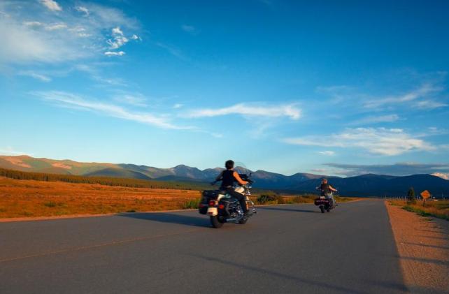
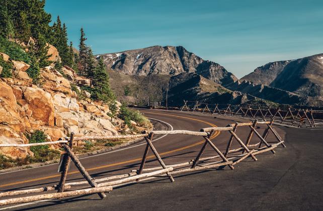
Scenic Drives & Byways

Winter Park has access to some of the best scenic drives in the Rockies, here are a few of our favorites!
Download the list of scenic drives.
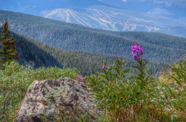
Rocky Mountain National Park/Trail Ridge Road:
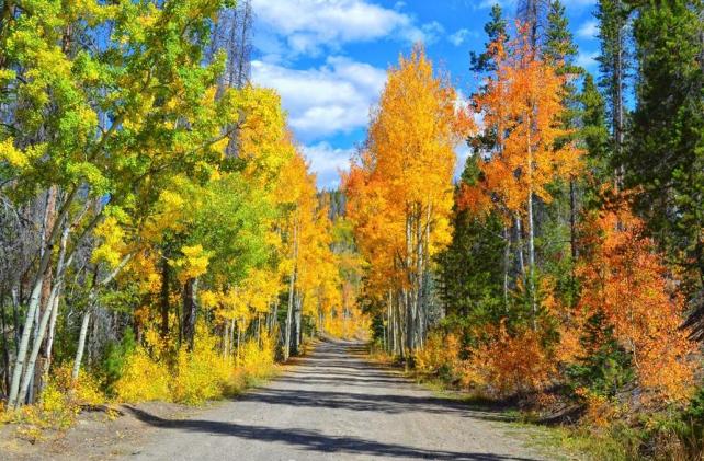
Not to be missed! Trail Ridge Road, the highest continuous highway in North America and one of Colorado’s most spectacular scenic drives winds its way through Rocky Mountain National Park, the fourth most visited national park in the country. This road crosses the Continental Divide and continues on to Estes Park on the eastern slope. Sightings of elk, bear and moose are common, and amazing photo opportunities abound. Listen to elk bugle and watch for the aspen to turn gold in the fall. Follow Hwy 40 west to Granby and then take a right on Hwy 34 16 miles to Grand Lake. The Kawuneeche Visitor Center (970.627.3471), just past Grand Lake, is a must-stop to gather information about hiking, animal viewing areas, historical information and road conditions. The Alpine Visitor Center at the top of Trail Ridge Road is a pleasant place for lunch. Allow for almost an entire day to spend time in the nation’s second-oldest National Park. NOTE: Normally closed mid–October to Memorial Day.
Corona Pass:
Enjoy this 15-mile rough dirt road to the top of the Continental Divide stopping at an old train trestle, a reminder of the incredible feat of taking trains over the mountain. There are beautiful views of the ski resort, town and surrounding area, so remember your camera. Drive Hwy 40 toward Winter Park Resort and past Idlewild Campground until you see a brown sign for Corona Pass Road. Take a left and follow signs to Corona Pass/Moffat Road/Rollins Pass/Forest Road 149. It's slow going due to loose rocks and erosion damage. An all-wheel drive vehicle is recommended at least for the upper third. It's approximately 14 miles to the top of the pass. Many hiking options are available from the top. Moffat Road historical book is available for purchase in the Winter Park Visitor Center. NOTE: Normally closed mid-Oct 1–mid June.
Willow Creek Pass:
Drive west through Granby on Hwy 40. At Windy Gap Reservoir, turn right on Colorado Hwy 125 to Willow Creek Pass (21.5 miles). Lodgepole pine, spruce and willows line Willow Creek as it meanders up to the pass. Be on the lookout for unusual rock formations along the river and sweeping views of Park Mt. and Rocky Mountain National Park. At the top of Willow Creek Pass, turn around and return to Hwy 40 or continue on Hwy 125 to Walden. You can make a loop back to Winter Park by going west on Hwy 14 just south of Walden to Steamboat Springs and the Yampa Valley for a beautiful all day excursion. Return on Hwy 40.
Or if you really want to see some backcountry, turn at County Road 123 to Stillwater Pass (see below).
Stillwater Pass:
County Road 123 is 4 miles below the summit of Willow Creek Pass; a sign indicates Stillwater Pass. The road is well maintained until a few miles below the summit. You will see the mountains of the Bowen Gulch Protection Area and the Never Summer Wilderness bordering Rocky Mountain National Park.
On the Grand Lake side take a left onto County Road 4, which is on the West side of Highway 34. The road follows through a subdivision and when the road turns to dirt, it becomes more remote. As it winds its way up the switchbacks, it becomes a jeep trail and is not recommended for low clearance vehicles. It can be driven to the other side, Colorado 125 (Willow Creek Pass), in an ATV or four-wheel drive. NOTE: Normally closed Nov–mid June.
Ute Pass:
From Winter Park follow Hwy 40 west through Hot Sulphur Springs and Byers Canyon to County Rd 3 on the left. Travel south on CR 3 past Williams Fork Reservoir following the Williams Fork River to CR 132 over Ute Pass. Enjoy the old ranches and panoramic views of the Gore Range and Eagle’s Nest Wilderness Area. Turn right (north) on Hwy 9 to Kremmling and back to Hwy 40. Go east on Hwy 40 back to Winter Park.
Colorado River Headwaters National Scenic Byway:
Dropping 1,700 feet in elevation from end to end, follow the mighty Colorado River as it begins its journey west to the Pacific. The scenic byway passes through mountain valleys and magnificent canyons along historical ranchlands and offers sweeping views of the Gore Range and Eagle’s Nest Wilderness Area. From Winter Park, follow Highway 40 west to the town of Kremmling approximately 45 miles. In the town of Kremmling, take a left on Route 9 (south) and drive approximate 5 miles to Grand County Road 1, also known at the Trough Road. The road meets up with the Colorado River as it exits the western end of Gore Canyon, with breathtaking views down to the river. Fishing, rafting, paddle boarding, tubing and hiking are available on the Colorado River below Pumphouse. State Bridge, which has a convenience store, cabins and an outdoor amphitheater for music in the summer, is the culmination of the drive. Return the way you came or take Hwy 131 to Wolcott and I-70 east over Vail Pass to Hwy 40 over Berthoud Pass. Take a picnic lunch and make day of it!
Church’s Park Road:
About ¼ mile west of Fraser on Hwy 40, turn left onto County Road 5. Pass the Fraser Sports Complex on your right and take the first left onto County Road 50, also known as Church’s Park Rd. After about 2 miles, the road will come to a “Y” intersection. Stay right here on County Road 50. After you pass the Crooked Creek Ranch-Young Life Camp, you will be in the national forest. You will soon see a sign for Forest Roads #139 and #133; stay on FR #139 at the junction for those roads. You have gone approximately 10 miles. Continue on to the junction for FR 134 and FR 139 and veer left to stay on 139. After 13.9 miles, you will come to Horseshoe Campground and the Williams Fork River. Continue over a small bridge and turn right at the next junction heading toward the town of Parshall (this is County Rd/Route 3). Continue on for another 14 miles on this road until you reach Hwy 40. Make a right on Hwy 40 to head back towards Hot Sulphur Springs, Granby and Winter Park (approximately another 30 miles). NOTE: Normally closed Nov 1–early June.
Cottonwood Pass Road:
From Winter Park, follow Highway 40 west approximately 10 miles to County Road 55 on the left. There will be a Colorado Scenic Byway sign that indicates Cottonwood Pass. As you wind your way up Cottonwood Pass, you will drive past some of the most historic ranches in the county. At the top, before you descend into the town of Hot Sulphur Springs, there is an informational sign with the history of the road, which once served as the mail route. The road continues to the town of Hot Sulphur Springs, where skiing began in Grand County, back to Highway 40. If you’d like to return to Granby and Winter Park, take a right. If you’d like to go to Parshall and Kremmling, take a left.
Maps
Grand County area maps are available at the Visitor Center as well as online.